|
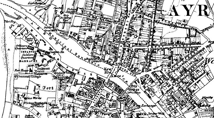
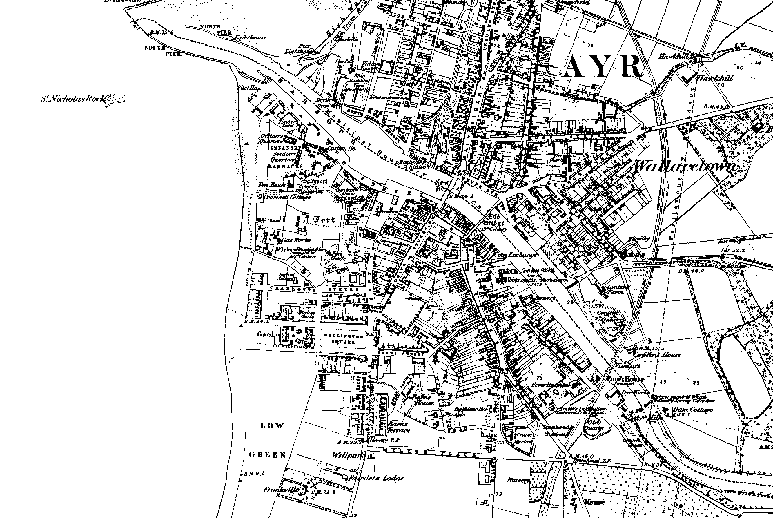
Map of auld Ayr showing New and Old
Bridges, Sandgate Street & Main Street.
Another very large
image with more detail is available Image produced
from the
www.old-maps.co.uk service with permission of
Landmark Information Group Ltd. and
Ordnance Survey |


